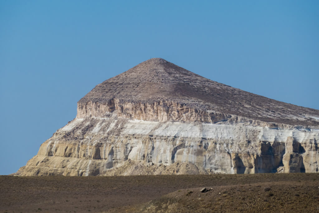
Aktolagay Plateau
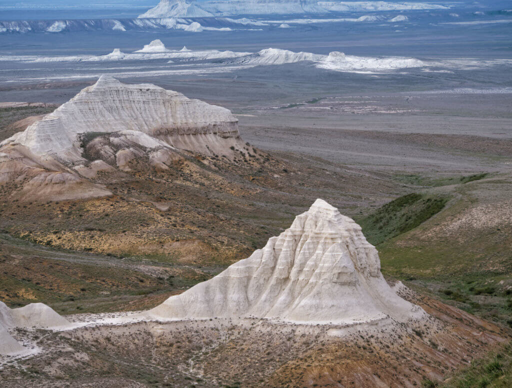
The Aktolagay Plateau is a cluster of freestanding chalk cliffs on the Aktobe-Atyrau regional border and 50km east of the smaller Akkegershin Plateau. It’s 50km long and less than 10km wide, although some report the range as larger, despite maps indicating otherwise. The southernmost end is 35km from the Emba River and its northern end […]
Aktau
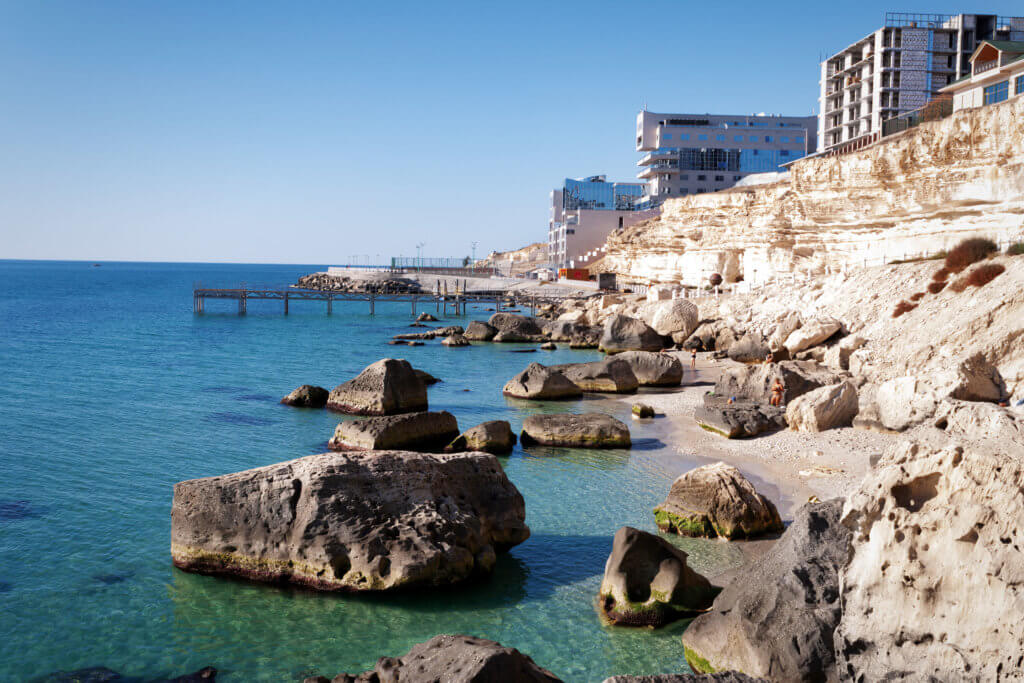
Aktau serves as a perfect starting point for journeys into the Ustyurt and the broader Mangystau Region. Its strategic location on the Caspian Sea, coupled with an array of cultural and historical landmarks, both within and just outside the city limits, makes it a place worth spending a day or two. History of Aktau The […]
New Alexander Fort
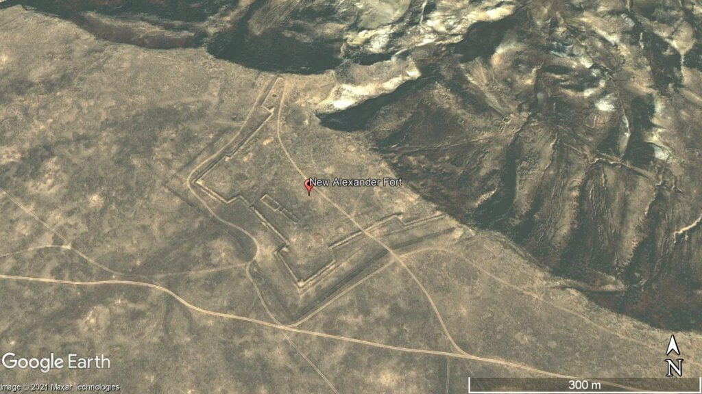
Overlooking Dead Kultuk is New Alexander Fort. It’s on the cliff edge of the Western Chink Ustyurt, on the east side of Kaydak Bay, and was in use from 1834–1846. Russian General Vasily Perovsky, who oversaw two attempts to conquer Central Asia in the Khiva and Kokand campaigns, ordered the fort to be built after […]
Aktau-Buzachinskiy Nature Reserve
Established in 1982, the Aktau-Buzachinsky Nature Reserve covers an area larger than Greater London. It’s little-visited, rarely written about, and features a diverse landscape of gorges, small valleys, and coastal plains overlooking the Caspian. The southerly extent stretches for 30km from eastern Sarytash Bay to Kochak Bay and into the Kimbelek Salt Marsh. Map Data: […]
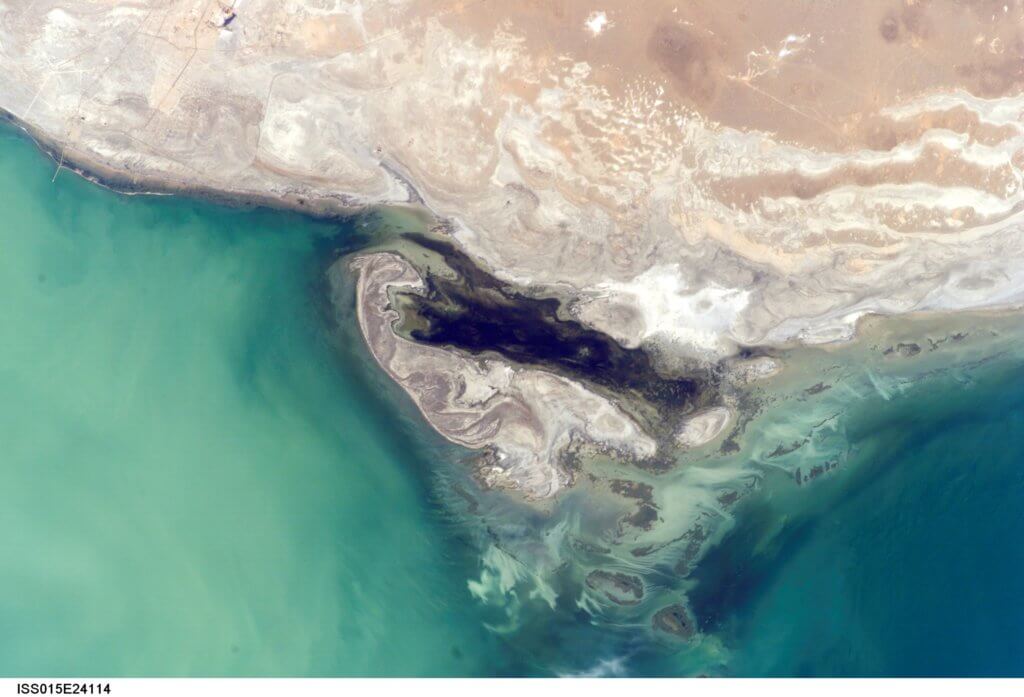
Kaydak Bay
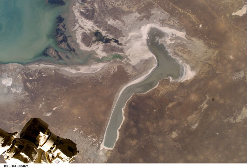
The Buzachi Peninsula’s far eastern edge overlooks the 15km x 100km Kaydak Bay salt marsh. A western branch of the bay’s shallow marshes extends more than halfway into the peninsula. Less than 200 years ago, when the Caspian Sea levels were a few metres higher, seawater covered these marshes, making the southern region of the […]
Dead Kultuk and Durnev Islands
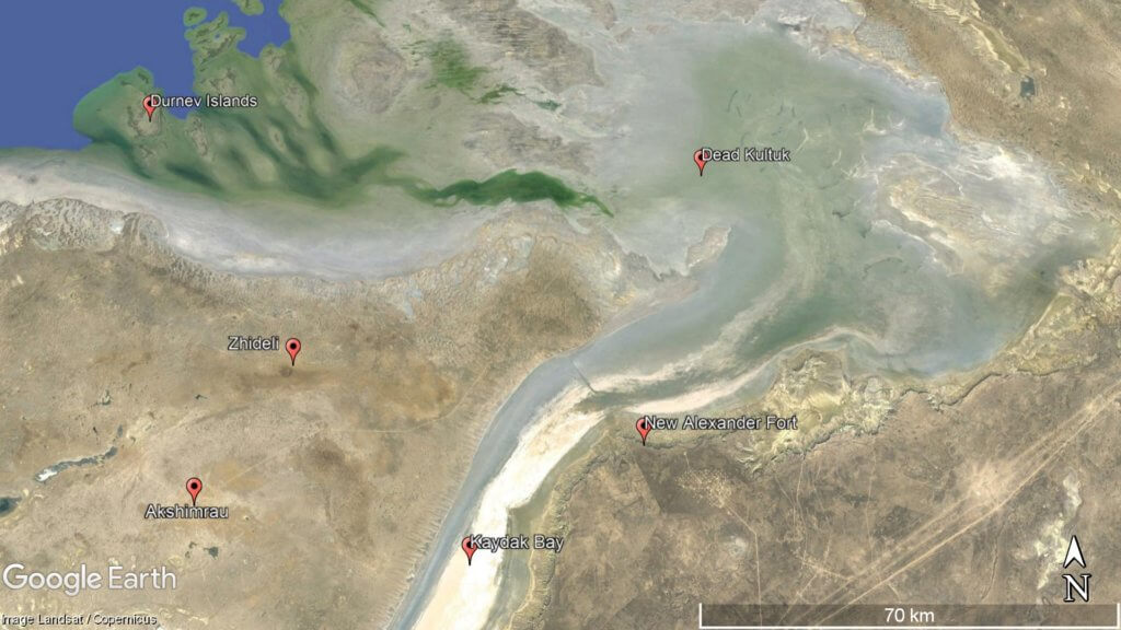
Dead Kultuk, which is an uninhabited chunk of salt marsh almost half as big as the Buzachi Peninsula, begins at the northern end of Kaydak Bay. From the 17th–20th century, Dead Kultuk has had three different names: the Blue Sea, on Emanuel Bowen’s 1747 Map of Persia; Tsesarevich Bay during the Russian Empire; and Komsomolets […]
Otpan Tau
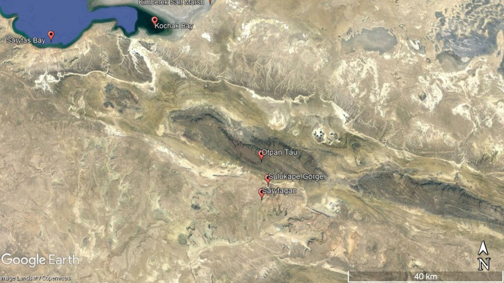
Otpan Tau (532m) is the Mangyshlak Peninsula’s highest point. From the summit, you can see unrestricted views of Mangystau’s vast steppe, the Caspian Sea, and endless numbers of weather-worn ridgelines and rock features. It’s in the middle of the West Karatau Range and previously served as a watchtower and fire-signalling point to alert residents to […]
Torysh Valley
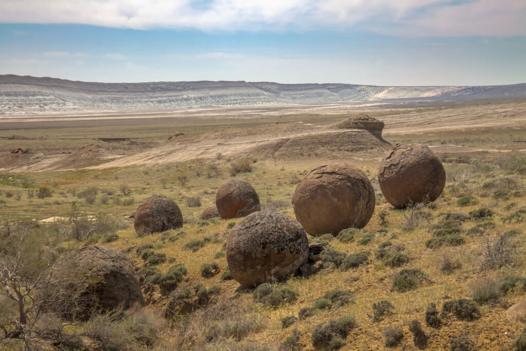
Eight kilometres east of the Aktau–Buzachi Peninsula road and 30km west of Sherkala is the ‘Valley of Balls’. Locally known as Torysh, the valley lies on the north side of the West Karatau Range and features hundreds of spherical sedimentary rocks up to 4m in diameter. © Mulderphoto Researchers believe they’re concretions – formed by […]
Sherkala
Sherkala (332m) is 5km west of Ayrakty-Shomanai on the northern side of the West Karatau Range. Its name is derived from the Persian words for lion (shir) and fortress (qalat), as its western aspect resembles a resting lion. Its southern aspect looks like a yurt and features on Kazakhstan’s 1,000 tenge banknote. Sherkala’s west face. […]
Golubaya Bay
On the south-west side of the Tub-Karagan Peninsula is the half-kilometre-long Golubaya Bay (aka Blue Bay), which is sandwiched between the Uzynkuduk and Tulkili Gorges. Less than a kilometre inland is Tulkili Fortress. Isolated stretches of sandy beach and unnamed rocky coves extend either side of the bay. Fifteen kilometres to the south is Cape […]