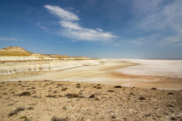
Karynzharyk Depression
Karynzharyk is an 85km long and 15km wide depression in the Ustyurt Nature Reserve. The nearest village is Ak-Kuduk, which is situated 25km to the
Otpan Tau (532m) is the Mangyshlak Peninsula’s highest point. From the summit, you can see unrestricted views of Mangystau’s vast steppe, the Caspian Sea, and endless numbers of weather-worn ridgelines and rock features. It’s in the middle of the West Karatau Range and previously served as a watchtower and fire-signalling point to alert residents to danger. It also served as a meeting point for clan leaders, religious recitations, and as a symbolic starting point for batyr heading into battle, which is an honorific Kazakh word for ‘warrior’.
On the summit, there’s a nearly 40-metre-tall monument to Adai Ata, a 15th-century leader of the Adai tribe. Beside the monument, there are two steles erected in honour of Adai Ata’s sons, Kudayke and Kelimberdy. Nearby, there’s a statue of Kokbori, the mythological Heavenly Wolf revered as the sacred foremother and protector of the Turkic people. In front of the main monument stands the 15-metre-tall Mother’s Image statue, built to honour Adai Ata’s wife. Sabyr Adai, a 20th-century Kazakh poet born in Karakalpakstan, encouraged the government to erect the Otpan Tau monuments to celebrate the region’s culture and history.
On the day of Nauryz, Adai’s ancestors meet on the summit for the Amal holiday, where they light a torch from a giant flaming bowl and hand it between clan members. The event symbolises the unification of Kazakhstan’s three territorial tribal divisions, known as zhuz.
There’s also an eight-room mausoleum, dedicated to Adai Ata’s eight grandchildren, and a history museum. Access to the monument is via a mountain road in between Tushchybek and Zhyngyldy. From the carpark, 362 steps lead up to the summit—one for each of Mangystau’s holy places.
Three kilometres south-west of Tushchybek village is the little-visited Sulukapi Gorge. The access road is 1km from the Otpan Tau turn-off. From Sulukapi’s mouth, it snakes its way south for more than 4km before finishing near to the ruins of Sarytagan.
Two routes connect Otpan Tau and Shetpe with Aktau. Both take roughly two hours. The A-33 road route heads east and north. The other route follows near to the coastline for 50km, heading toward the Tub-Karagan Peninsula, before turning right for Tauchik town. Near Tauchik there’s a cross junction, left goes to the town and right heads east to Otpan Tau and Shetpe. For a detour, Danyshpan Ata and Doly Apa Cemeteries, as well as the remains of a mine, are less than 6km from Tauchik.
Otpan Tau (Отпан-тау): 44.1882, 51.8895
Road to Otpan Tau: 44.1618, 51.8947
Sulukapi Gorge (Sulukapi Şatqaly/Ущелье Сулукапы) entrance: 44.1289, 51.9112
Sulukapi Gorge Access Road: 44.1627, 51.8833
Sarytagan Ruins (Sarytağan/Сарытаган): 44.0953, 51.8902
Tushchybek Village (Tūşchybek/Тущибек): 44.1469, 51.9410
360-degree panoramic view from Otpan Tau’s summit.
Photos, 360-degree video and drone footage from Otpan Tau.

Karynzharyk is an 85km long and 15km wide depression in the Ustyurt Nature Reserve. The nearest village is Ak-Kuduk, which is situated 25km to the

Eight kilometres south of Kyzyl Ravine is Sor Tuzbair*, a salt marsh stretching 15km along the edge of the Western Chink Ustyurt. Along with Boszhira,

Twenty kilometres north of Senek village is Shopan Ata, a circa 10th-century underground mosque that is one of Mangystau’s oldest religious sites. It was first
Copyright © Planet Esoterica, 2024. No part of this site, www.planetesoterica.com, may be reproduced in whole or in part in any manner without the permission of the copyright owner. All rights reserved.
Made with 