Buzachi Peninsula Deserts
If you’re interested in obscure, remotely situated deserts, the Buzachi Peninsula has five small, sandy ones*: the Kyzylkum, Uvahkum, Shulshagylkum, Zhilimshik and Egizlak. The Kyzylkum begins on the outskirts of Shebir village, extending 30km west to Kiyakty, where it merges with the similarly sized Uvahkum. Running close to the Caspian coastline’s edge, Uvahkum transforms into […]
Saura Canyon
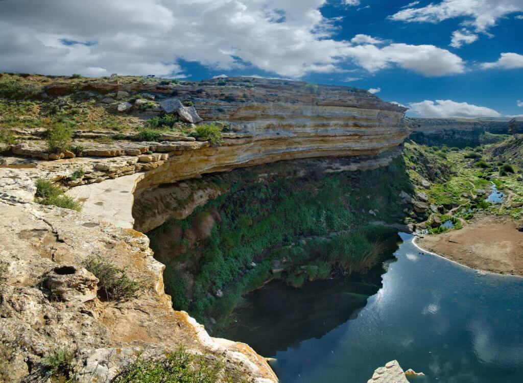
North of Golubaya Bay is a dirt road running along the edge of the plateau and coastline to Saura Canyon, which has an abandoned Soviet-era fishing village of the same name. Keep an eye out for the remains of old wheeled-cart tracks cut into the plateau’s soft limestone, which were created by centuries-old fishmongers travelling […]
New Alexander Fort
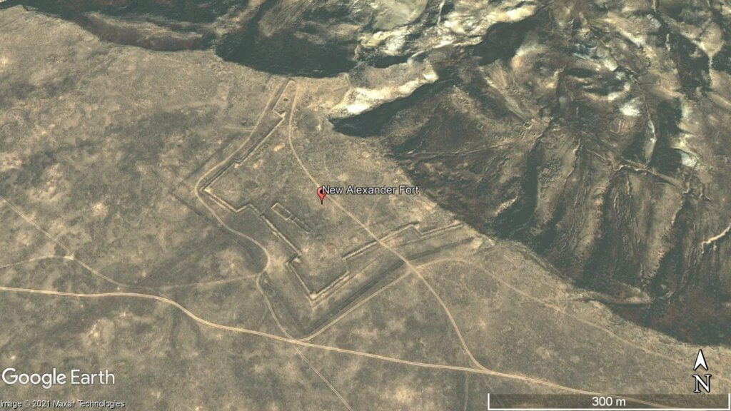
Overlooking Dead Kultuk is New Alexander Fort. It’s on the cliff edge of the Western Chink Ustyurt, on the east side of Kaydak Bay, and was in use from 1834–1846. Russian General Vasily Perovsky, who oversaw two attempts to conquer Central Asia in the Khiva and Kokand campaigns, ordered the fort to be built after […]
Aktau-Buzachinskiy Nature Reserve
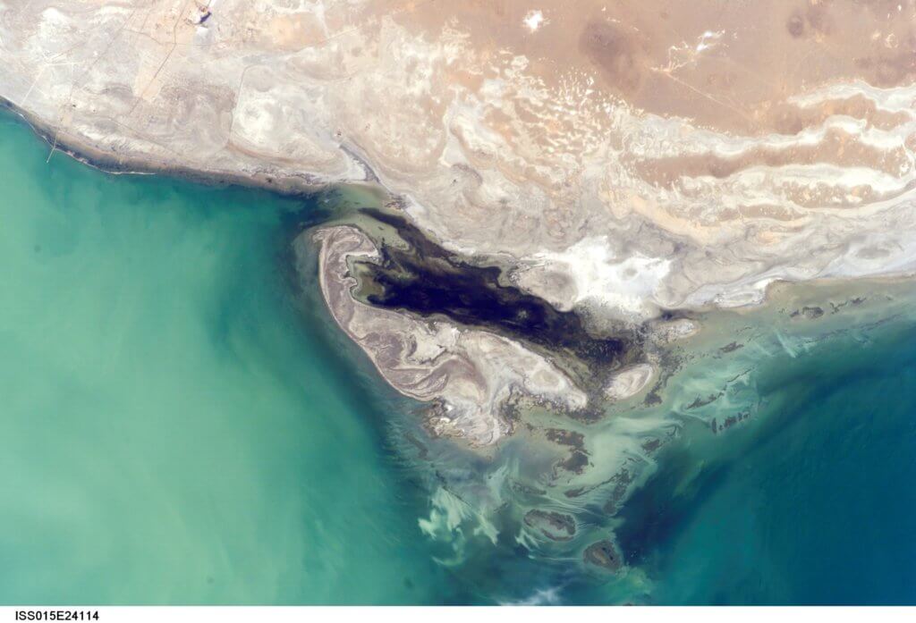
Established in 1982, the Aktau-Buzachinsky Nature Reserve covers an area larger than Greater London. It’s little-visited, rarely written about, and features a diverse landscape of gorges, small valleys, and coastal plains overlooking the Caspian. The southerly extent stretches for 30km from eastern Sarytash Bay to Kochak Bay and into the Kimbelek Salt Marsh. Map Data: […]
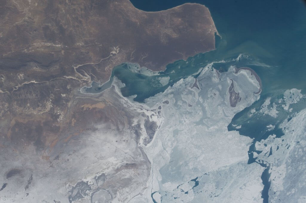
Kaydak Bay
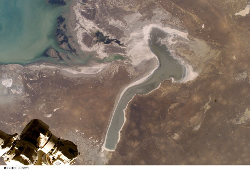
The Buzachi Peninsula’s far eastern edge overlooks the 15km x 100km Kaydak Bay salt marsh. A western branch of the bay’s shallow marshes extends more than halfway into the peninsula. Less than 200 years ago, when the Caspian Sea levels were a few metres higher, seawater covered these marshes, making the southern region of the […]
Dead Kultuk and Durnev Islands
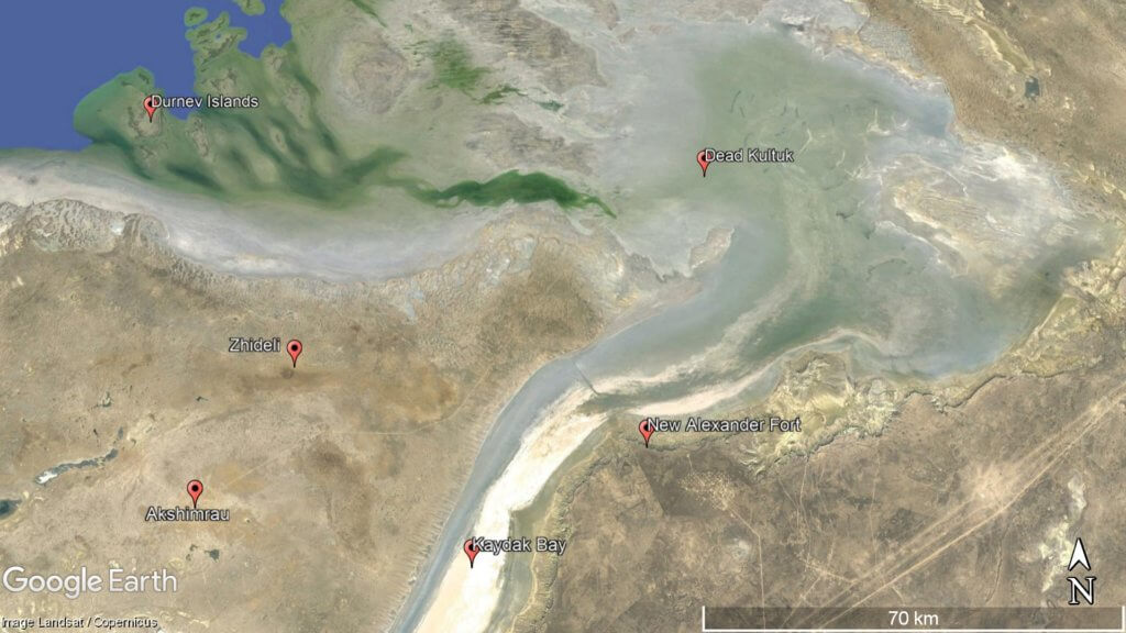
Dead Kultuk, which is an uninhabited chunk of salt marsh almost half as big as the Buzachi Peninsula, begins at the northern end of Kaydak Bay. From the 17th–20th century, Dead Kultuk has had three different names: the Blue Sea, on Emanuel Bowen’s 1747 Map of Persia; Tsesarevich Bay during the Russian Empire; and Komsomolets […]