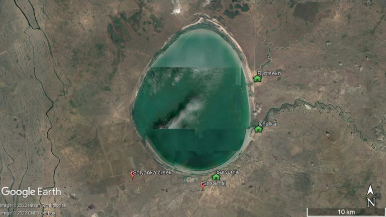
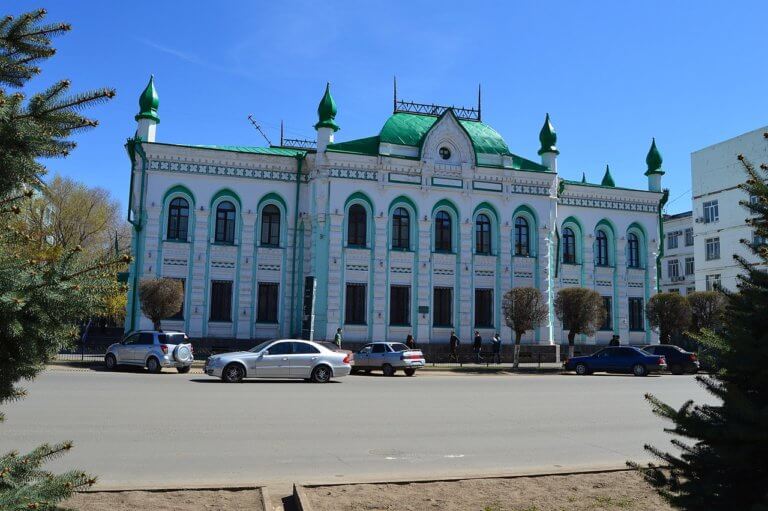
Buzachi Peninsula Deserts

If you’re interested in obscure, remotely situated deserts, the Buzachi Peninsula has five small, sandy ones*: the Kyzylkum, Uvahkum, Shulshagylkum, Zhilimshik and Egizlak. The Kyzylkum begins on the outskirts of Shebir village, extending 30km west to Kiyakty, where it merges with the similarly sized Uvahkum. Running close to the Caspian coastline’s edge, Uvahkum transforms into a network of inter-dune saline areas. The combined surface area of the deserts is similar in size to the Big Tract Salt Marsh, which covers the peninsula’s north-west quarter. Approximately 10km south of the marsh is the minor Shulshagylkum, which is connected to the Kyzylkum’s north end.

The Zhilimshik Sands stretch from the north-eastern edge of the Buzachi Peninsula, near Dead Kultuk, to Zhideli settlement. From there, it merges with the smaller Egizlak Sands, which extends another 15km to the west. The combined east–west measurement of the two deserts is 45km. Few people live here, aside from half a dozen farmsteads between eastern Zhilimshik and Zhideli. Thirty kilometres south is the nearest town, Akshimrau.

* Referred to as ‘пески’ in Russian and ‘кум’ in Central Asia’s Turkic languages, meaning ‘sands’.

Map Data: Google, © 2021 Maxar Technologies, CNES / Airbus, Landsat / Copernicus
Satellite view of the entire Buzachi Peninsula with Kaydak Bay on the far right and Tyub-Karagan Peninsula in the bottom left.
Map Data: Google, © 2021 Landsat / Copernicus

Buzachi Peninsula’s Ancient History

Shebir stands as the most archaeologically significant location on the Buzachi Peninsula, with several New Stone Age and Copper Age dig sites. The discoveries at the Shebir-4 excavation include ceramics that share design similarities with those found in Turkmenistan’s Jeitun* and Iran’s Tepe Sialk sites. There’s also hand-moulded earthenware bearing direct resemblance to the Copper Age Khvalynsian peoples of the 5th–4th century BCE, who lived in the Middle Volga and North Caucasus regions and introduced metallurgy and domesticated sheep to Mangystau.

The book Archaeology of Kazakhstan by K.M. Baipakov and Zh.K. Taymagambetov unveils fascinating discoveries in Shebir. Among these are sizeable collections of ceramic fragments and flint, a pit filled with sand and red ochre – supposedly used for religious rites – along with over 100 small flakes and blades. It’s believed the early settlers used locally sourced silicon as a raw material in the manufacture of tools and weapons, too. No arrowheads have been found at Shebir, although this is made up for with the discovery of numerous composite tool inserts.

* Also known as Dzheitun and Djeitun.

Desert Mausoleums

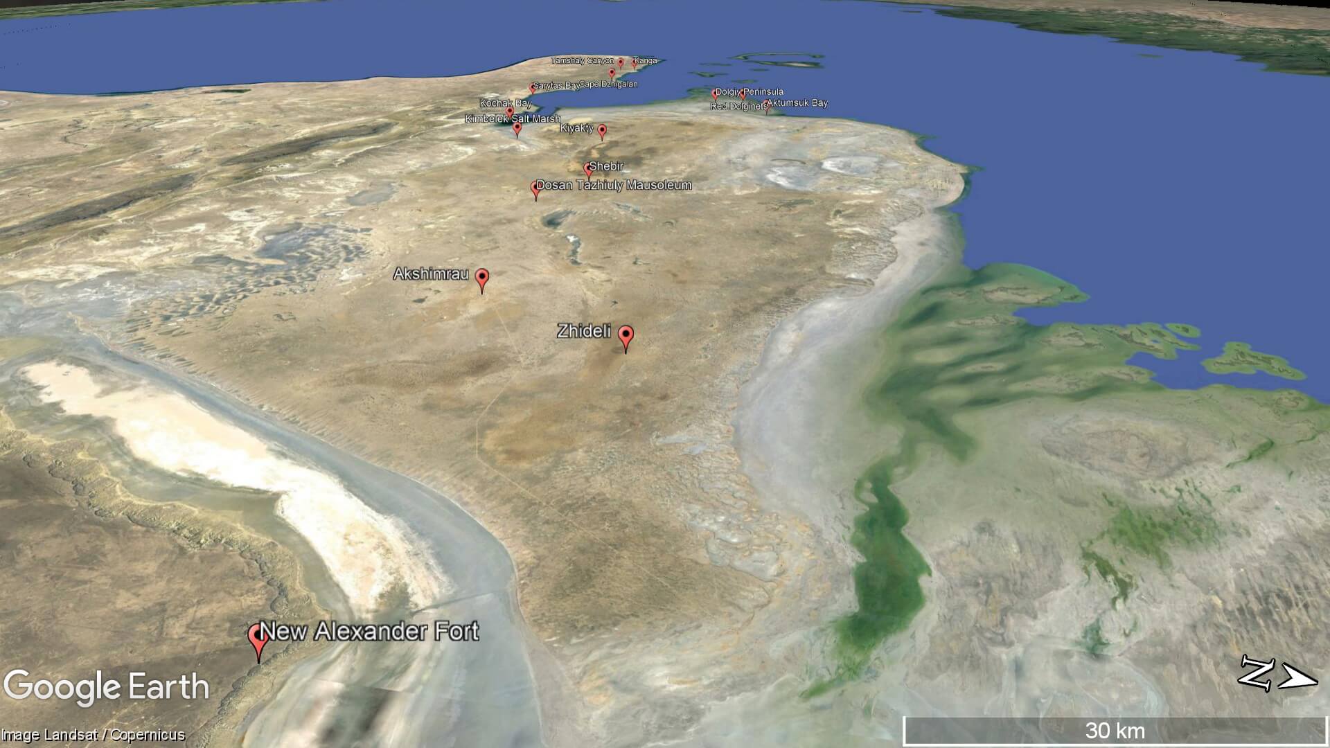
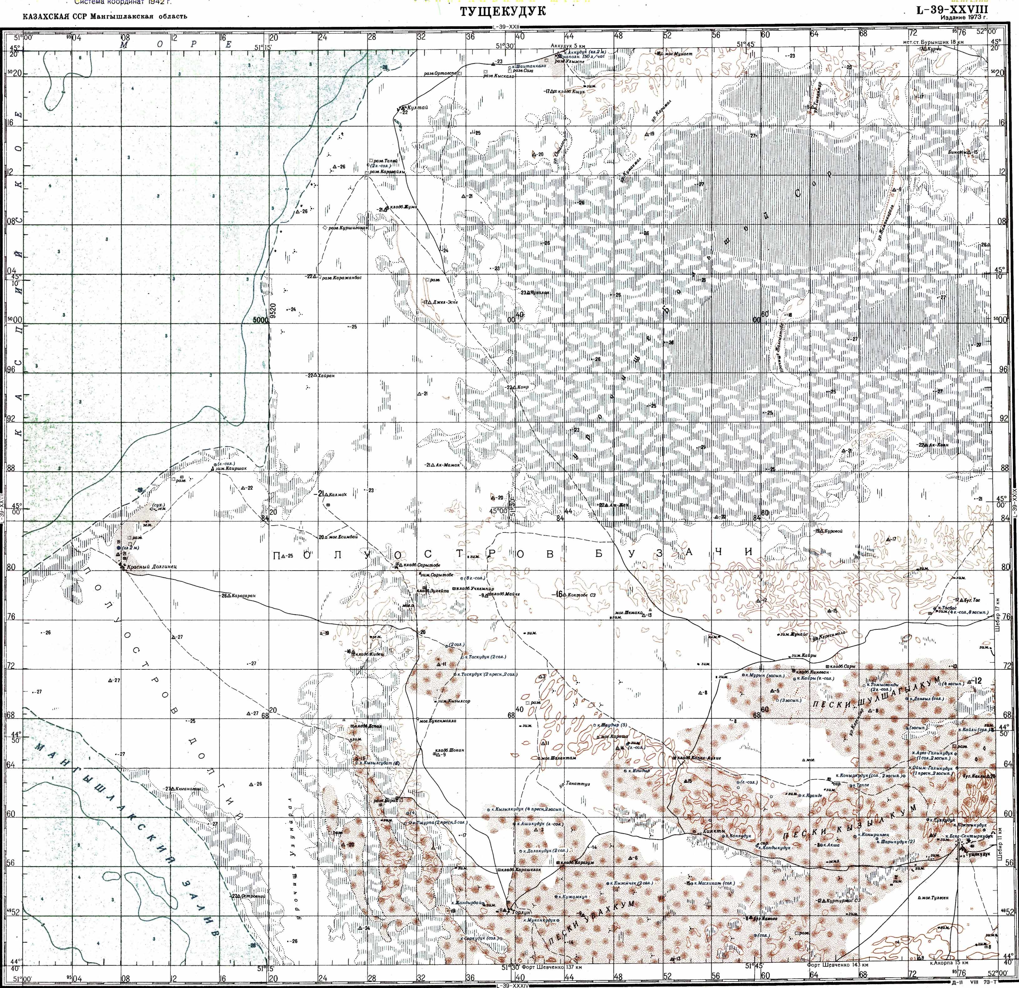
Fifteen kilometres south-east of Shebir is the Mausoleum of Dosan Tazhiev, co-leader of the Adayev Uprising with Isa Tlenbayuly, whose commemorative statue stands in Fort Shevchenko. He was born in Zhideli and is most famous for beating Lieutenant Colonel Nikolai Rukin in Ushauyz, on Kochak Bay’s southern coast. In 1874, he was captured in Sam Sands*, some 35km north of the Uzbek border, and died two years later in prison in Fort Shevchenko. His body was returned to the peninsula, and a mausoleum erected in his memory not long after. Many consider him as the first of Mangystau’s inhabitants to take a stand for independence. Eighteenth-century Sufi saint Beket Ata’s Tobykty underground mosque is 20km to the south-east.

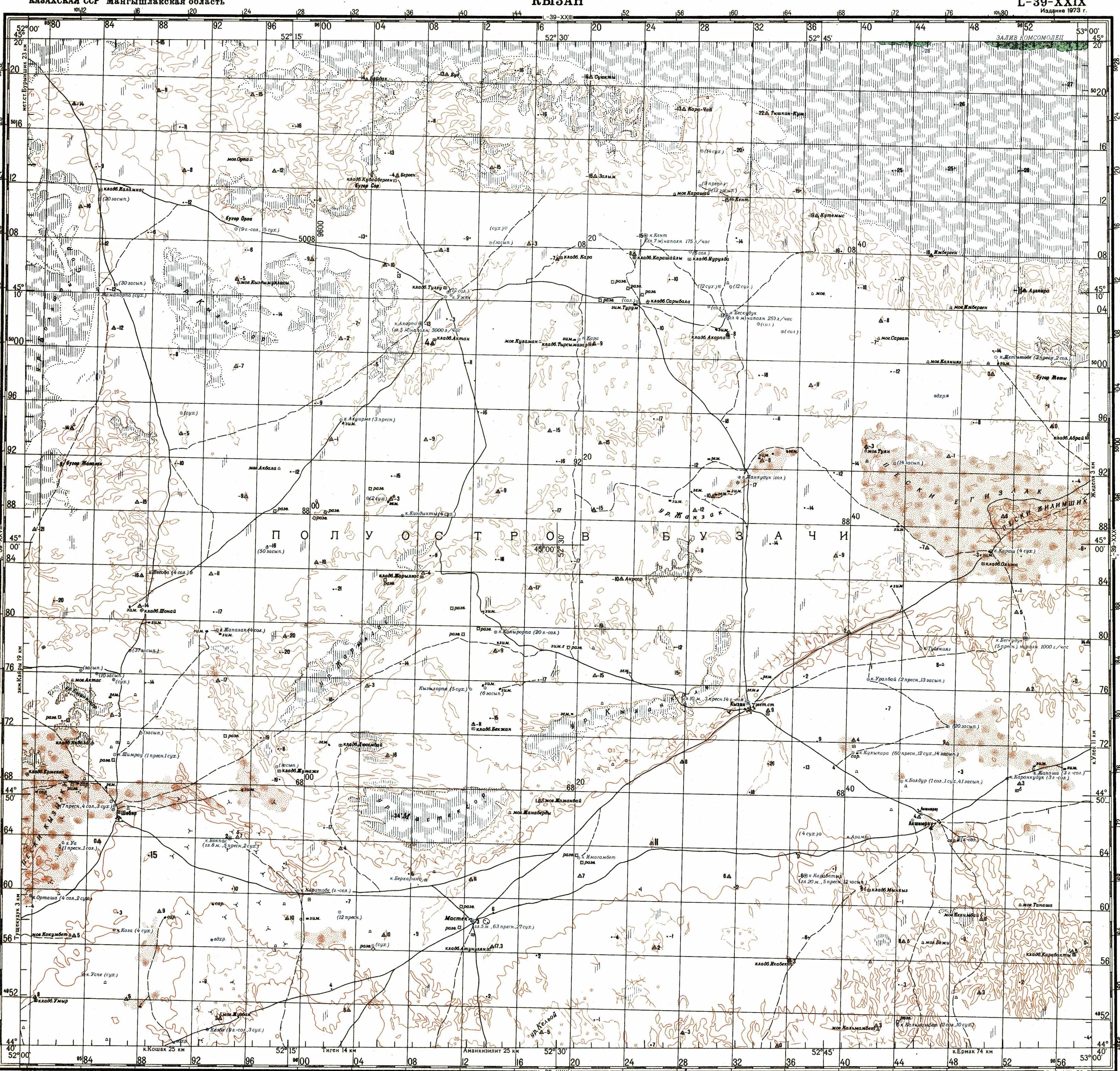
The 14th-century Mausoleum of Kokkumbet lies 17km west of Tazhiev’s, on the outskirts of Tushikuduk village. At roughly 100m², according to satellite images, it’s one of the largest mausoleums in the eastern Caspian region. Its construction features slabs up to one metre in length, earning it the nickname ‘Karatam’ among the local population. While this term lacks a direct translation, it’s meant to convey the mausoleum’s sturdy stone composition.

As per the unconfirmed oral history and local legend, Kokkumbet devoted his life to finding a mythical spring that granted eternal life. Yet, despite his tireless efforts, the spring remained elusive. However, one fateful day, he encountered a blue bird that had been drinking from the very spring he sought. In a moment of revelation, he realised that consuming the bird would bestow upon him the eternal life he craved. With his newfound prize in hand, he hurried back to his village, only to find its men preparing for war. Filled with a sense of duty, he joined their ranks and left the bird behind.

Unaware of the bird’s extraordinary power, Kokkumbet’s wife prepared it as a meal while he was away. She ate the bird and fed the bones to their dog, inadvertently granting them the gift of immortality.

Upon his return from the battlefield, Kokkumbet was dismayed to discover the bird’s fate. Though he longed for the eternal life he had been so close to grasping, it was too late. In the end, he was buried in his homeland, while his wife and dog lived on, forever bound by the mystical power of the blue bird.

* ‘Пески Сам’, when translated directly from the Russian, means ‘Itself Sands’ or ‘Myself Sands’. However, the true origin of this name remains elusive to us.

Looking southward at the Buzachi Peninsula, pictured in the bottom left and covered in frost (February 2018). The Tyuleniy Islands (right) are surrounded by sea ice. The dry peninsula is Tub-Karagan and Bautino Port is tucked inside the small stick-like land spit (in the top right). Image courtesy of the Earth Science and Remote Sensing Unit, NASA Johnson Space Center (http://eol.jsc.nasa.gov)

Coordinates:

  • Shebir (Şebir/Шебир): 44.8138, 52.0887

  • Kiyakty (Qiiaqty/Киякты): 44.7600, 51.6946

  • Big Tract Salt Marsh (Ülken Sor Traktaty/Урочище Большой Сор): 45.1433, 51.7610

  • Zhideli (Jidelı/Жиделі): 45.0395, 53.0268

  • Akshimrau (Aqşymyrau/Акшимирау): 44.8217, 52.8304

  • Kokkumbet Mausoleum (Kökkümbet Kesenesı/Мавзолей Коккумбет): 44.7386, 52.0479

  • Dosan Tazhiev Mausoleum (Dosan Täjiev Kesenesı/Мавзолей Досан Тажиев): 44.7641, 52.2687

  • Beket Ata Mosque – Tobykty (Beket Ata Meşıt – Tobyqty/Мечеть Бекет Ата – Тобыкты): 44.6535, 52.4543

  • Kyzylkum (Qyzylqūm/Кызылкум): 44.7653, 51.7955

  • Uvahkum (Uvahqūm/Увахкум): 44.6923, 51.6236

  • Shulshagylkum (Şūlşağylqūm/Шулшагылкум): 44.86721, 51.9030

  • Zhilimshik Sands (Jılımşık/Жилимшик): 45.0162, 53.0217

  • Egizlak Sands (Egızlaq/Эгизлак): 45.0310, 52.7983

  • Sam Sands (Пески Сам): 45.4746, 56.4989

Resources:

  • 1:200k Soviet map of Kyzylkum and Uvahkum Sands, extending across the bottom third. Big Tract Salt Marsh is in the top-right quarter and the Shulshagylkum is beneath it.

  • 1:200k Soviet map of north-east Buzachi Peninsula. Egizlak Sands is on the far right, adjoining the western edge of the Zhilimshik Sands. The bottom-left quarter, on the map’s edge, is the Kyzylkum’s eastern half.

  • 1:200k Soviet map of Kaydak Bay and the Buzachi Peninsula, with the Zhilimshik Sands’ two branches at the far eastern edge extending eastward to the bay.

Planning a visit? Check out our debut guidebook

Other places included in our publication:

Golden-coloured sand dunes with Senek village in the background and chalk cliffs further beyond.

Senek Sands

Senek Sands, also known as Tuyesu Sands, is an 11 x 30km area of dunes located halfway between Zhanaozen city and Boszhira. Barchan dunes cover

Read More »
Wide shot of grey clouds over the Ural River in Atyrau.

Atyrau

Atyrau, a bustling city less than 15km from the Caspian Sea’s north coast, sits amid the stark beauty of the Caspian Lowland. Surrounded by sandy

Read More »