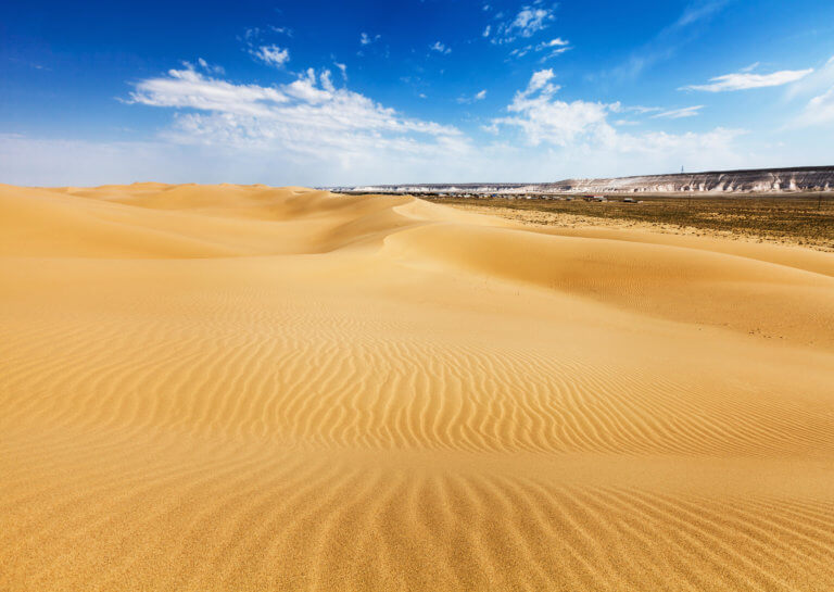
Senek Sands
Senek Sands, also known as Tuyesu Sands, is an 11 x 30km area of dunes located halfway between Zhanaozen city and Boszhira. Barchan dunes cover
Forty kilometres west of the Aktau-Buzachinsky Nature Reserve, on the Tub-Karagan Peninsula’s north coast, is the rubble-strewn landscape of Cape Zhygylgan, meaning ‘fallen’ in Kazakh. An enormous landslide created the area, caused by erosion of the sand and clay layered beneath the dense limestone bedrock.
The slide zone itself is 2–3km wide and extends over 4km north before terminating on the Caspian shore. Backed by a steep and crumbling cliff line dozens of metres high, hundreds of rocks and boulders dot the area. Some blocks have 10–15-million-year-old fossilised footprints of hipparions – which are three-toed prehistoric horses – and sabre-toothed tigers.
If you like boulder-hopping, there are a couple of footpaths weaving right through the slump zone. There are also dirt tracks leading down to the sea, which is 2.5km away, on the eastern and western edge of the cliff line. Kuzdakary, a mini soccer-pitch-sized lake, lies in a depression on the eastern path. It’s near an abandoned water well that’s over a hundred years old, from a time when people lived in the area. Stretching 10–15km on either side of the cape – between Cape Bagardzhik and Cape Ashchymuryn – are a half dozen more ancient coves to explore.
Cape Zhygylgan (Jyğylğan Müiısı/Мыс Жыгылган): 44.6075, 50.8352 (eastern edge descent) and 44.5915, 50.7881 (western edge descent)
Cape Bagardzhik (Bagarjik Müiısı/Мыс Багарджик): 44.6337, 50.5980
Cape Ashchymuryn (Aşymūryn Müiısı/Мыс Ащымурын): 44.5555, 51.0011
Richly illustrated Cape Zhygylgan photo story.
A half-hour drone video of Cape Zhygylgan with impressive shots capturing the immensity of the formation.
1:200k Soviet map showing Cape Zhygylgan in the top right.
1:200k Soviet map of north-eastern Tub-Karagan Peninsula with Cape Ashchymuryn peeking out on the top-left edge, overlooking the large Sarytash Bay.
Senek Sands, also known as Tuyesu Sands, is an 11 x 30km area of dunes located halfway between Zhanaozen city and Boszhira. Barchan dunes cover
Oral is a lively city nestled on the banks of the Ural River. Like Atyrau city, it marks the geographical divide between Europe and Asia.
Perched on the western tip of the Tub-Karagan Peninsula is the city of Fort Shevchenko and its satellite port town of Bautino. It’s the Mangystau