Boszhira is Central Asia’s rival to the USA’s Monument Valley National Park, with the bonus of no crowds. Packed into a 7km x 7km area are several distinct red sandstone rock formations set atop waterworn chalk slabs. The most striking are the Azu Tisteri rock spires, meaning ‘fang teeth’ in Kazakh. Without a doubt, these twin peaks are the Ustyurt’s most iconic and photographed spot. Extending north from Azu Tisteri is the table-top ridge of Ulken Keme, and Borly Tau, which is surrounded by impenetrable cliffs.

Boszhira's twin-peaked Azu Tisteri rock pinnacles bathed in golden sun.
Azu Tisteri's twin peaks, with the southern end of Ulken Keme's table-top plateau on the far left. In the distance is Ushkir Tau's white ridgeline and the Karashek salt marshes in the far horizon. © Tatiana Mayurova Sall

Ushkir Tau, a 1.5-kilometre-long ridge, marks Boszhira’s southernmost point and has sheer drops on either side. Ten kilometres south of Ushkir Tau is Karashek, a salt marsh frequently seen in the background of Boszhira photographs, but rarely visited. Aside from venturing down to the valley floor, the best place to view Boszhira is from the Western Chink Ustyurt, which towers a couple of hundred metres above the main peaks.

Satellite view of Boszhira, with locations of mountains and viewpoints.
Map Data: Google, © 2021 CNES / Airbus, Maxar Technologies.

There are five popular viewpoints along the chink where you can take in the entirety of Boszhira and glimpse other mountains, such as Shoky Tau. Keep an eye out for ancient hunting traps called ‘desert kites’. Hundreds dot the cliff edge, some of which are up to 2,000 years old, and were used for hunting saiga, goitered gazelle, and other ungulates.

Coordinates:

  • Karashek Salt Marsh (Sor Qaraşek/Сор Карашек): 43.3017, 54.1268

  • Borly Tau (Borli Tauy/Гора Борли): 43.4290, 54.0776

  • Shoky Tau (Şoki Tauy/Гора Шоки): 43.4376, 54.0438

  • Bokty Mountain (Bokti Tauy/Гора Бокти): 43.4226, 53.7998

  • North and South Azu Tisteri (Soltüstık jäne Oñtüstık Azu Tısterı/Северный и Южный Азу Тистери): 43.4168, 54.0725

  • Ushkir Tau (Üşkır Tauy/Гора Ушкир): 43.4013, 54.0982

  • Ulken Keme (Улькен Кеме): 43.4237, 54.0708

Resources:

  • 1:200k Soviet map of Boszhira, shown in the bottom-left corner and west of spot height “287”.

  • 1:500k Soviet map of Karashek, Boszhira and the Karynzharyk Depression. Karashek is the blue lake on the far left of the map and the chain of spot heights north of it is Boszhira. A small blue lake marks the northern end of Karynzharyk.

  • French research project Globalkite’s interactive map showing the location of Eurasia’s desert kites.

Planning a visit? Check out our debut guidebook

Other places included in our publication:

ayrakty-shomanai-landscape-in-sunset

Ayrakty-Shomanai

Fifteen kilometres north-west of Shetpe town is Ayrakty-Shomanai, or as 19th-century Ukrainian artist-poet Taras Shevchenko preferred to call it during his stay in Mangystau, ‘The

Read More »
A cluster of six rock balls sitting in a desolate stretch of Kazakh desert.

Torysh Valley

Eight kilometres east of the Aktau–Buzachi Peninsula road and 30km west of Sherkala is the ‘Valley of Balls’. Locally known as Torysh, the valley lies
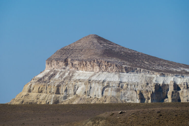
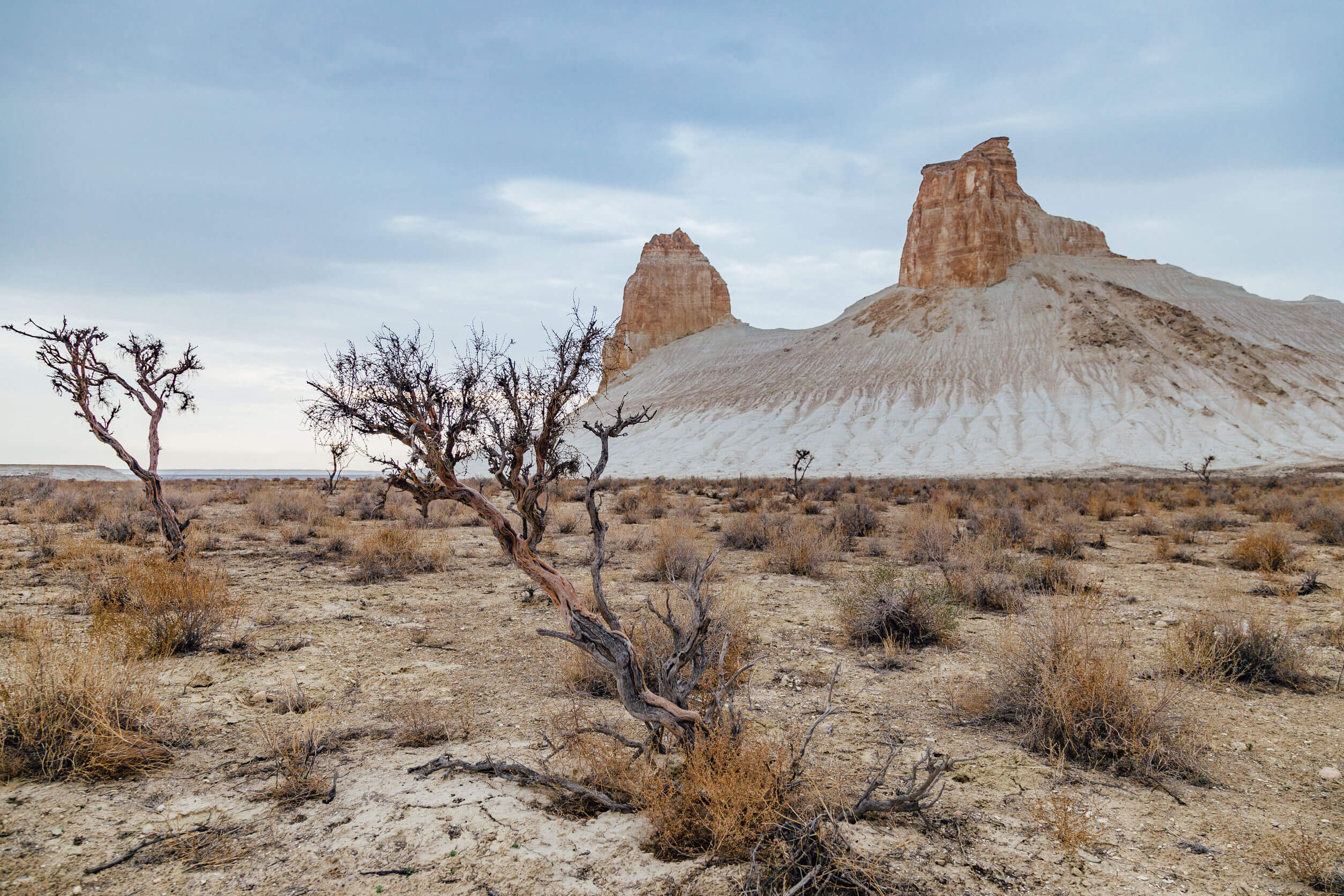
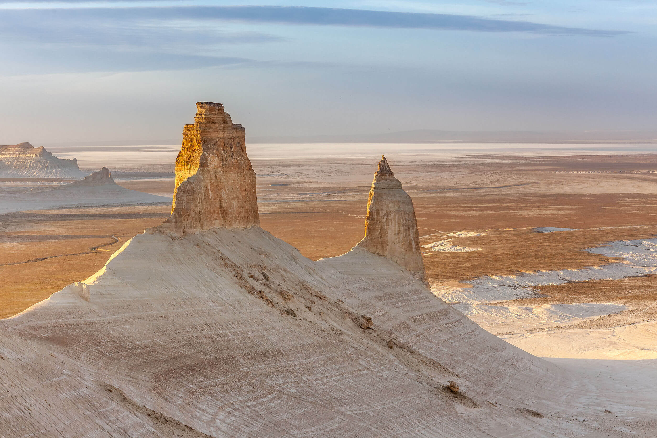
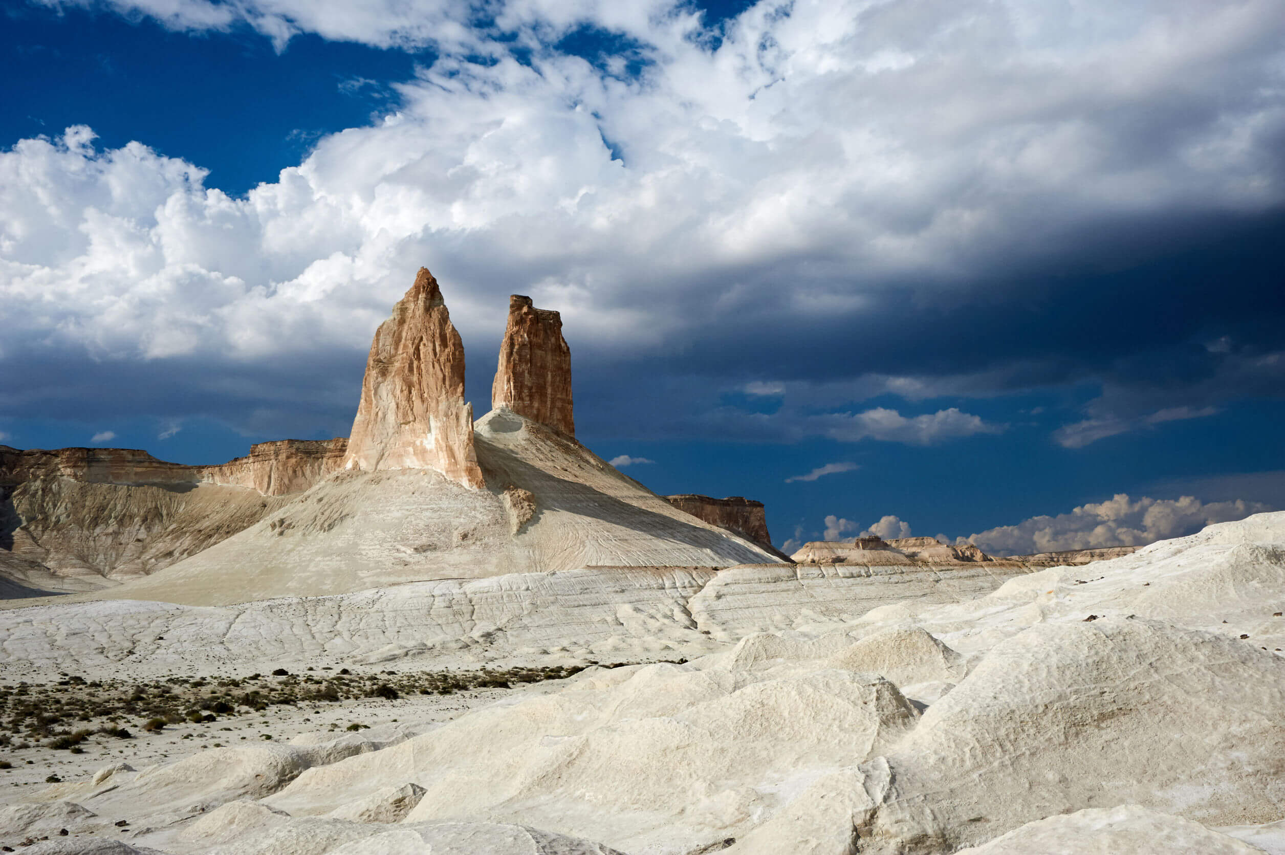
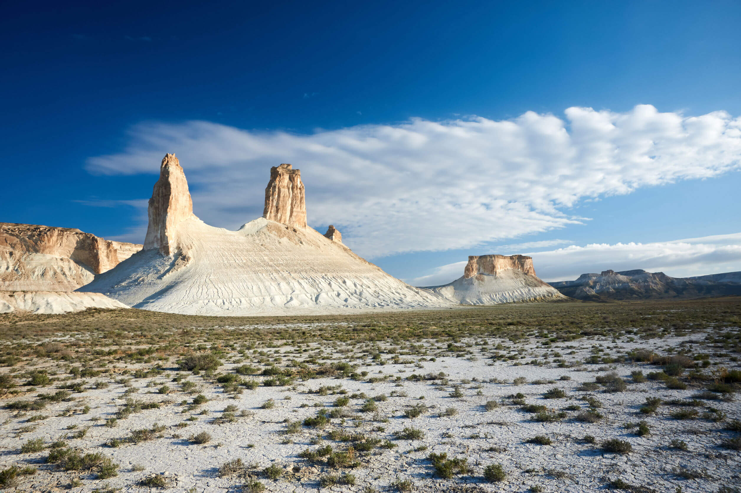
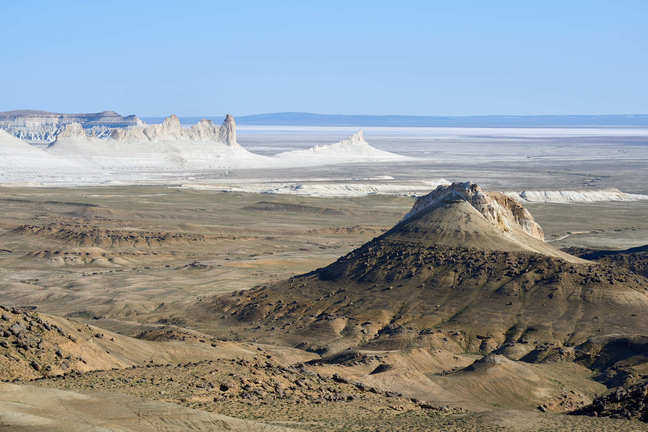
Read More »
Wide view of Sor Tuzbair from the plateau.

Sor Tuzbair

Eight kilometres south of Kyzyl Ravine is Sor Tuzbair*, a salt marsh stretching 15km along the edge of the Western Chink Ustyurt. Along with Boszhira,

Read More »