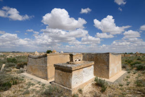
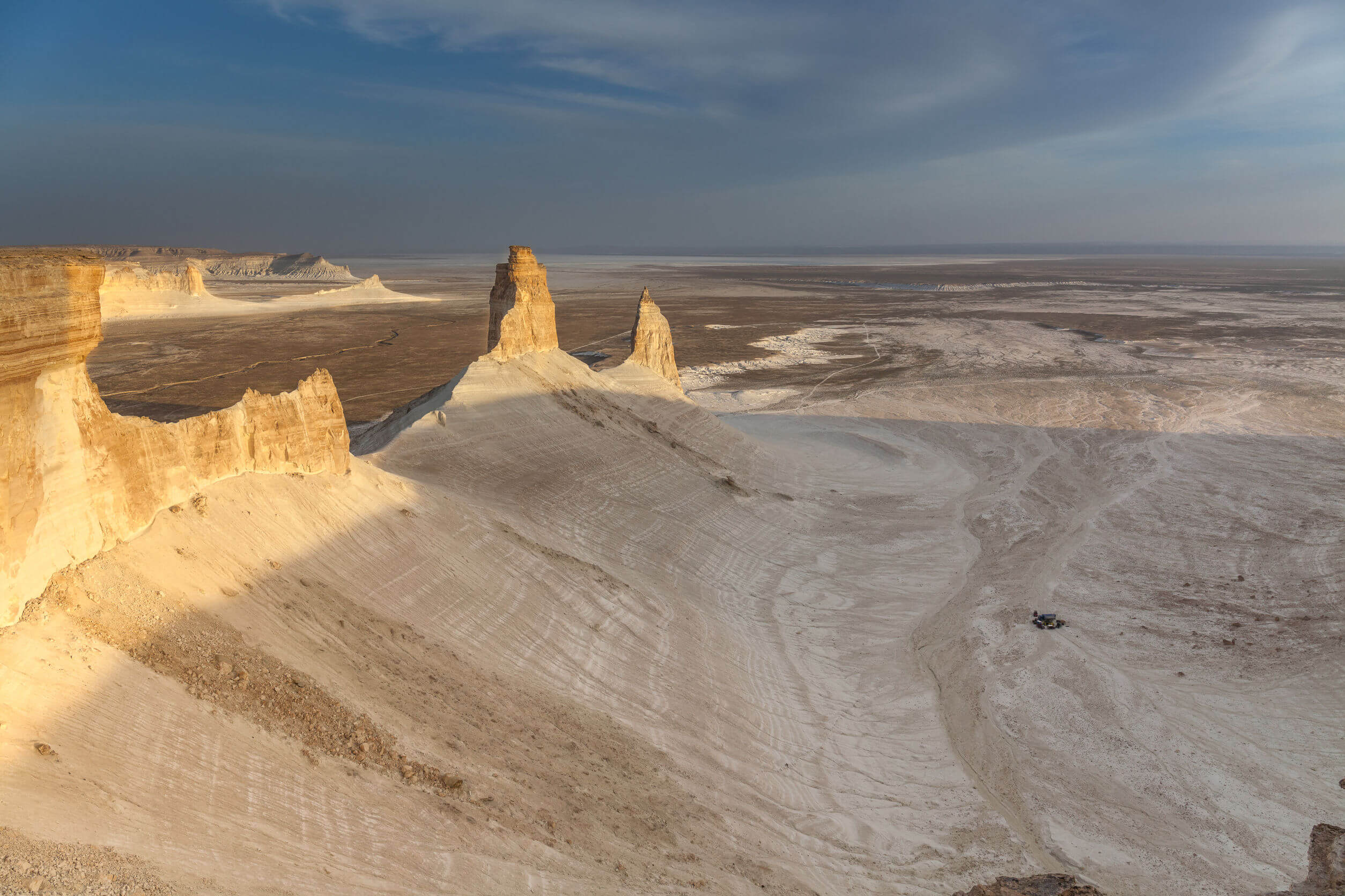
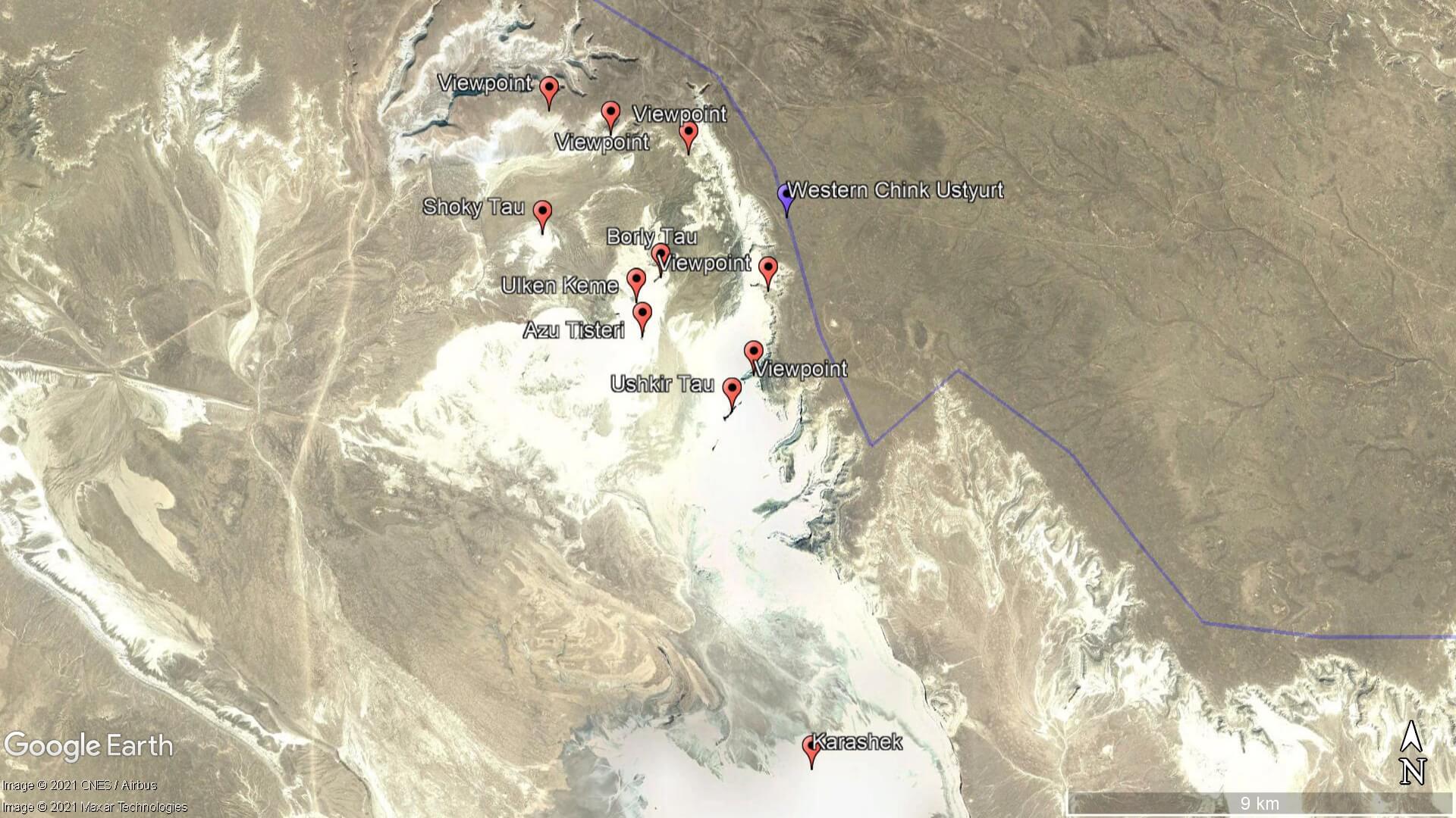
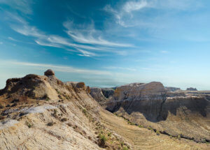
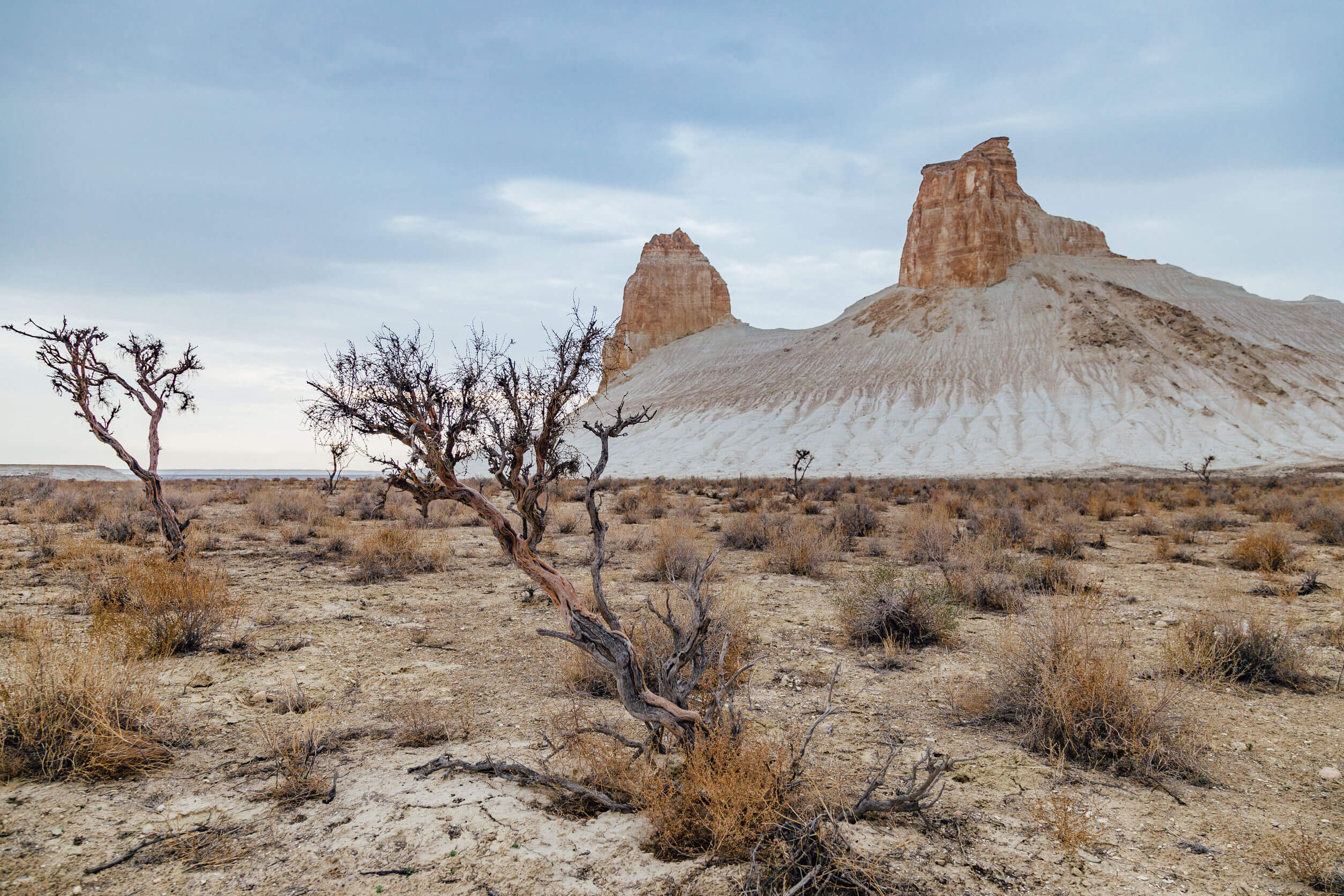
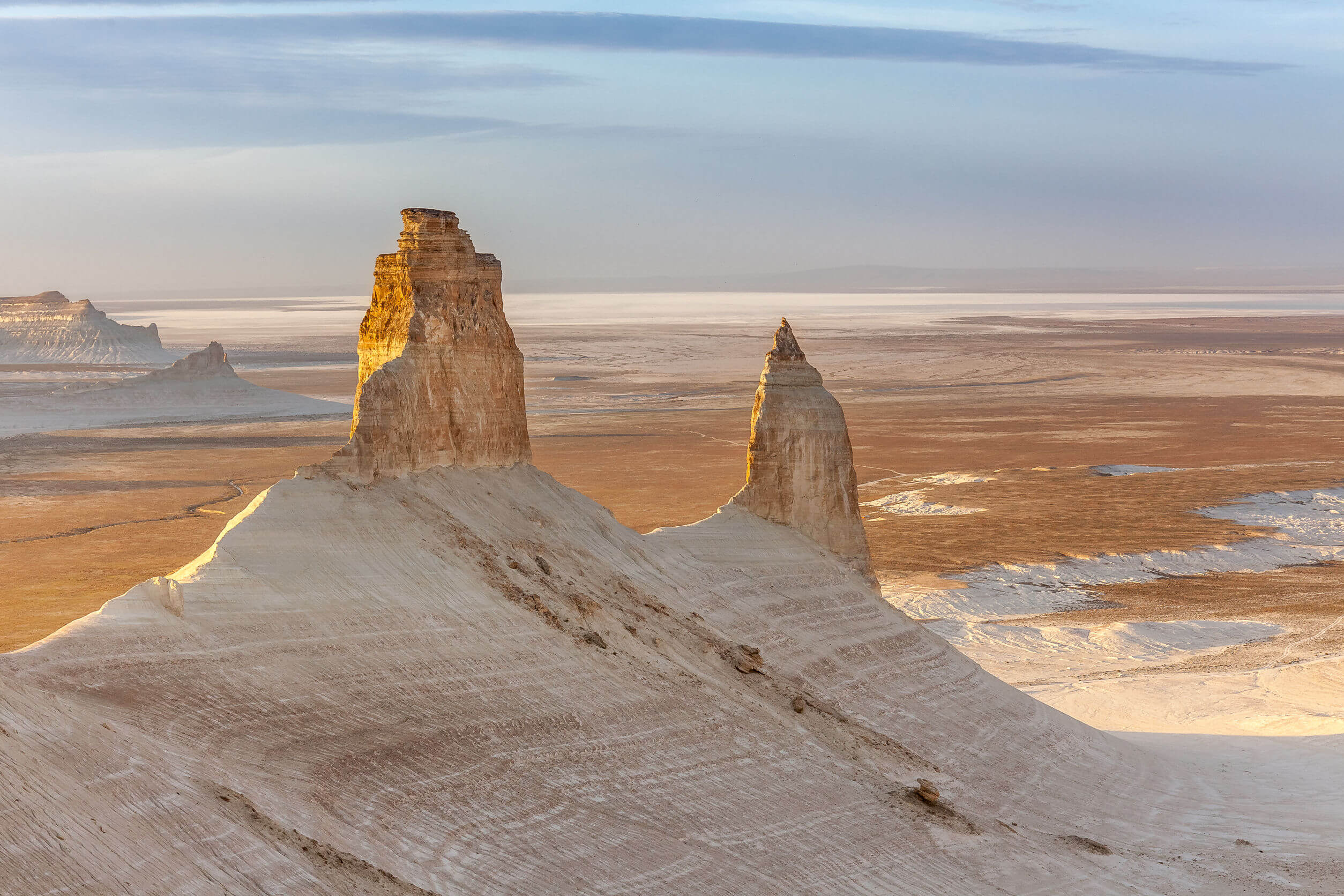
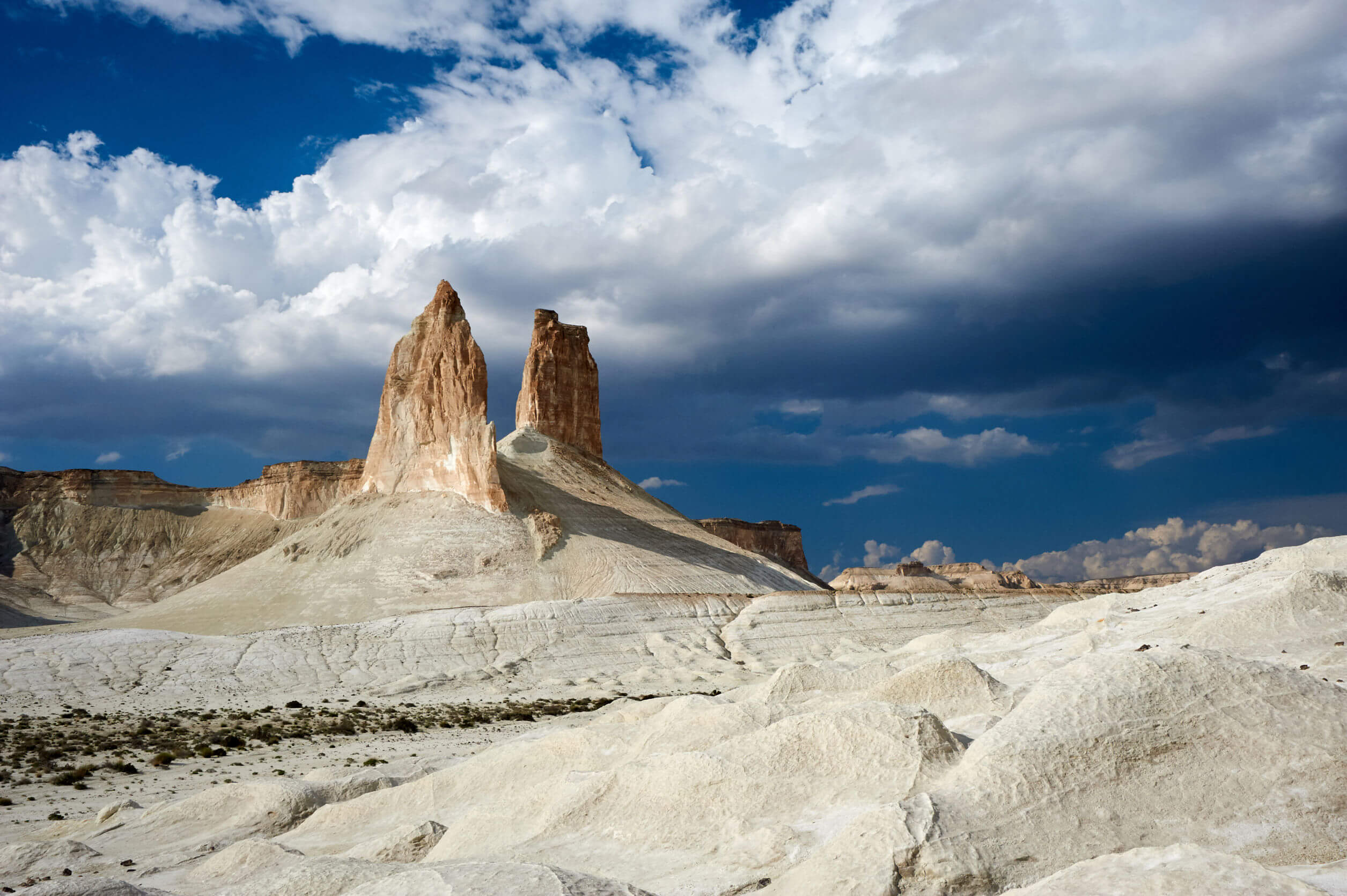
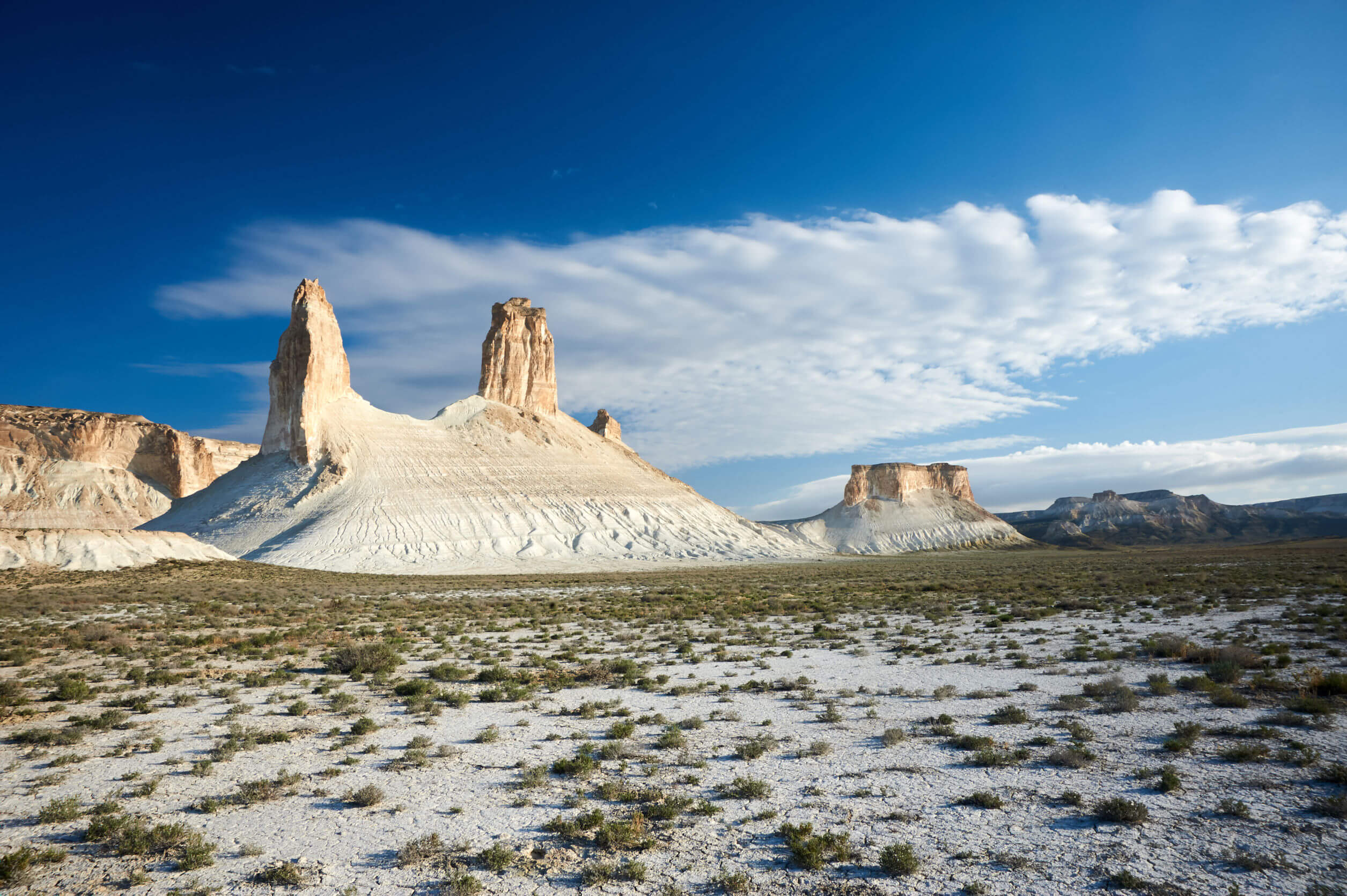
Boszhira (Босжира) is Central Asia’s rival to the USA’s Monument Valley National Park, with the added bonus of no crowds. Packed into a 7 x 7 km area are several distinct red sandstone rock formations set atop waterworn chalk slabs. The most striking are the Azu Tisteri rock spires, meaning ‘fang teeth’ in Kazakh. Without a doubt, these twin peaks are the Ustyurt’s most iconic and photographed spot. Extending north from Azu Tisteri is the table-top ridge of Ulken Kamen, and Borly Tau which is surrounded by impenetrable cliffs.
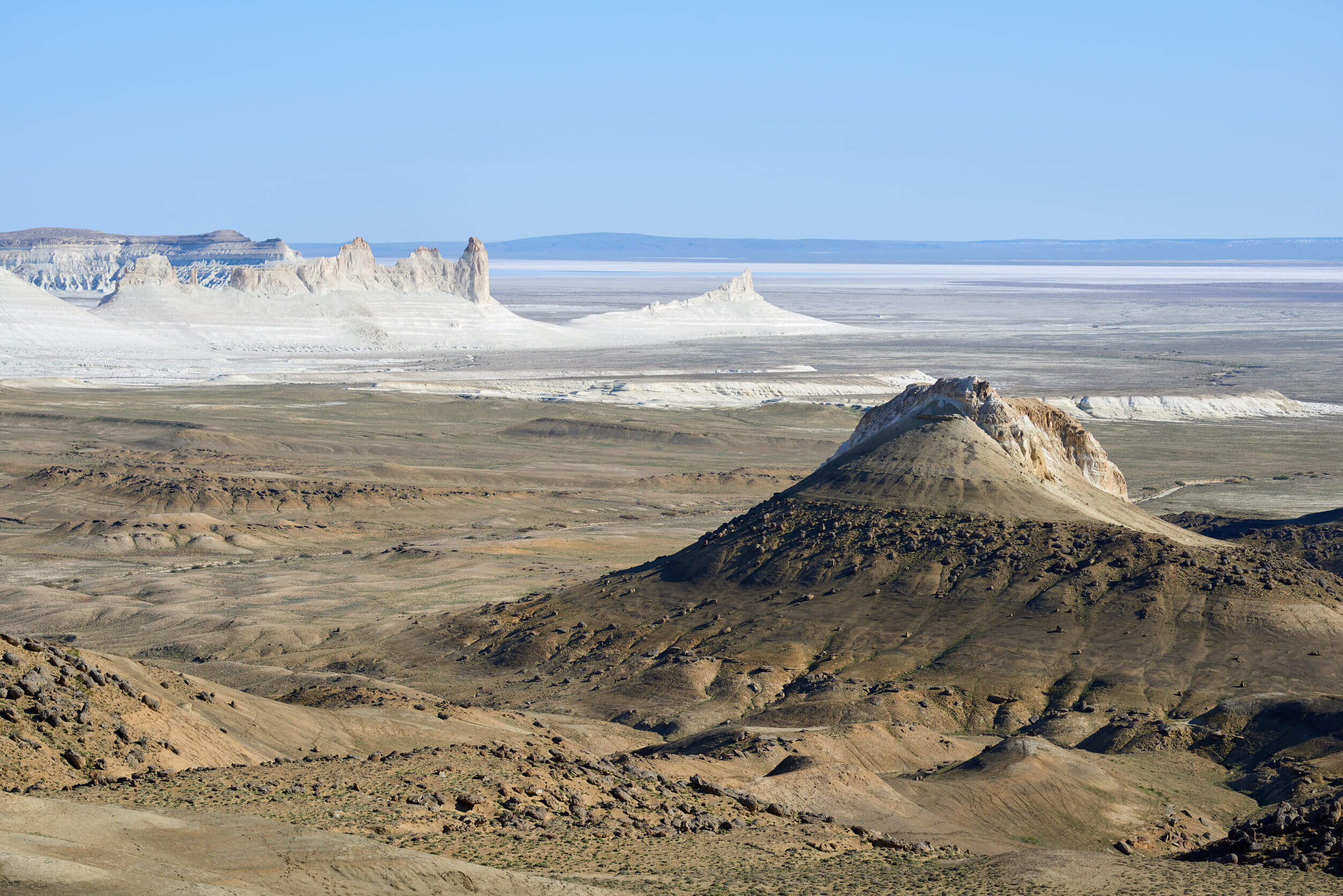
Boszhira’s southernmost point is marked by a jagged 1.5 km ridge called Ushkir Tau, which has sheer drops on either side. Ten kilometres south of Ushkir Tau is Karashek salt marsh, which is frequently seen in the background of many Boszhira photographs, but rarely visited. Aside from venturing down to the valley floor, the best place to view Boszhira is from the Western Chink Ustyurt, which towers a couple hundred metres above the main peaks.
There are five popular viewpoints along the chink where you can take in the entirety of Boszhira and glimpse other mountains, such as Shoky Tau. Be sure to keep an eye out for ancient hunting traps called ‘desert kites’. There are hundreds of them dotted along the cliff edge, some of which are up to 2,000 years old, and were used for hunting saiga, Jairan antelope, and other ungulates.
1:200k Soviet map of Boszhira, shown in the bottom left corner and west of spot height ‘287’.
1:500k Soviet map of Karashek, Boszhira and Karynzharyk Depression. Karashek is the blue lake on the far left of the map and the chain of spot heights north of it is Boszhira. The northern end of Karynzharyk is marked by a small blue lake.
 BY PLANET ESOTERICA