Ryn Desert
The Ryn, also known as the Naryn Sands, is Kazakhstan’s westernmost desert. It spans for over 350km between the Volga and Ural Rivers, and over

The Ryn, also known as the Naryn Sands, is Kazakhstan’s westernmost desert. It spans for over 350km between the Volga and Ural Rivers, and over
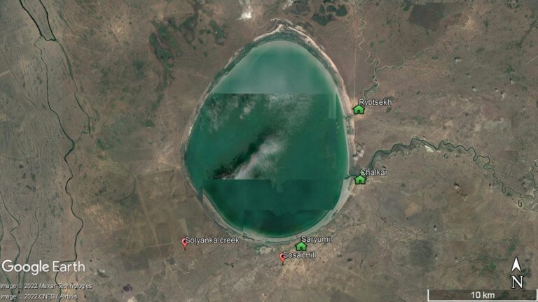
The brackish, egg-shaped Shalkar Lake – 65km south of Oral – measures 15km x 18km and receives water from two rivers on the east side:

Overlooking Dead Kultuk is New Alexander Fort. It’s on the cliff edge of the Western Chink Ustyurt, on the east side of Kaydak Bay, and